
--------------------
So we had the fortunate experience to hike several trails while on vacation. This is just one of them and my favorite one. I highly recommend it and would love to go back to just hike the trails again.
The first trail we did was a 5 mile trek but ended up being 6 miles from all the wandering. This trail is at the Tahquamenon Falls State Park between the lower falls and the upper falls. Enjoy!
 |
| My new favorite sign! |
 |
| Trail Map |
 |
| Lower falls |
 |
| Lower falls - can also go on boats on an island |
 |
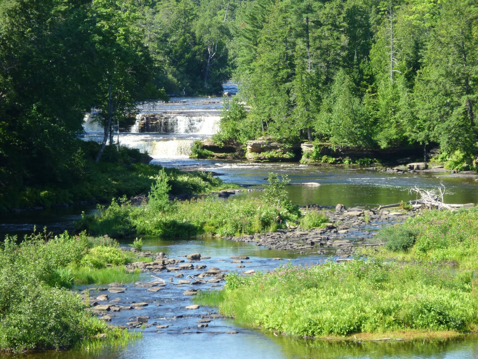
| river |
 |
| more lower falls |
 |
| lower falls |
 |
| lower falls |
 |
| creeks all throughout the trail |
 |
| same creek |
 |
| boardwalk on trail |
 |
| Notice my water pack - got lots of use |
 |
| Little Prayer |
 |
| Another creek |
 |
| lower falls close up |
 |
| lower falls close |
 |
| observation by lower falls |
 |
| lower falls |
 |
| dump into lower falls |
 |
| lower falls even closer |
 |
| lower |
 |
| very powerful huh? |
 |
| Up the river |
 |
| tree roots and rocks on trail were very common |
 |
| next to the river |
 |
| on the trail; there is one right? |
 |
| another creek |
 |
| more roots on trail |
 |
| tree next to trail |
 |
| more roots |
 |
| makeshift steps on trail |
 |
| bridge on trail(sort of) |
 |
| Yes, that is steps from nature |
 |
| More steps on trail(amazing huh?) |
 |
| Crazy how the trees grow! |
 |
| another creek |
 |
| single track with bees - wife did not like that |
 |
| calm river |
 |
| single track |
 |
| That is a tree that fell over - huge! |
 |
| trail? Yup! |
 |
| manmade stairs on trail |
 |
| more river |
 |
| lots of fallen trees |
 |
| crazy huge tree roots |
 |
| Looks like a beaver got this tree |
 |
| more single track |
 |
| Yes, this is the trail still |
 |
| At upper falls on manmade steps(110 of them) |
 |
| Upper falls from afar |
 |
| Upper falls |
 |
| Having a great time! |
 |
| Upper falls closer |
 |
| Upper falls from above |
 |
| Observatory near the upper falls |
 |
| 50,000 gallons per minute over falls |
 |
| Pennies for wishes, look at them shine! |
Here's the hike we did on the Garmin map. I didn't use it for every hike but thought it would be fun to try on this one:

441 feet of elevation gain and 292 feet of elevation loss for the 6 mile trip plus over a couple hundred steps
I used the Treksta Evolution II trail shoes for all the hikes/runs that week and will have a review in the next week or so on them.
I'll post the waterfalls we saw near Pictured Rocks on another post. I think that's enough pictures for today, don't you think? Haha!
Have a great day and.....Keep Running!!!!!!

oh my gosh, I love that first pic. The scenery looks gorgeous! I hope you had a great trip.
ReplyDeleteThat is beautiful! What a great place to hike!
ReplyDeleteGorgeous! What a great trip!
ReplyDeleteHave you ever checked out the Trail Atlas of Michigan? It's a rather large book but includes all the non-motorized trails in the state. Maps, tips, all you need to know. (shameless plug, my Dad writes the book, but I think you'd like it)
Beautiful. Great place to hike.
ReplyDeleteThe first lower falls pic was my favorite - what an amazing place!
ReplyDeleteLisa - I'll look into it - it sounds great!
ReplyDeleteAwesome pictures! I would love to go hiking in those trails!
ReplyDeletelooks like a great time!
ReplyDelete